✍️Mapping Google Maps' location to Mappls' MapmyIndia location
In this article, I talk about how to look up locations on Google Maps to MapmyIndia. This is especially useful for drone users of India to identify Green, Yellow and Red zones with more precision on the DigitalSky app.


Hi! My name is Narendra Vardi, and I write about my learnings, observations and trends in the Software world. Besides software, I also talk about photography, travel stories, books and movies. If that's something that interests you, consider subscribing.
In this article, I wanted to discuss about how one can map a Google maps location to a MapMyIndia location.
This article is primarily focused on helping drone pilots in India who need to identify if an area falls under Red, Yellow or Green zones.
The DGCA's Airspace Map is an interactive map of India that shows if a location falls under Green or yellow or red zones across the country.
Airspace Map uses Mappls' MapmyIndia for showcasing the zones. MapmyIndia works well (only in the context of Airspace Map) when the location is quite famous or historic. But If you are in a remote area where there is no clear landmark, it fails to show the zones and the user will be forced to search visually. Besides this downside, Airspace Map doesn't identify your location also. This could be for security reasons but still, it is not an easy activity if the app forces the users to make unnecessary effort to search the MapmyIndia app visually and manually.
To solve this problem, I have come up with the idea of searching for a remote location (or current location) on Google Maps and then using the coordinates of the same on MapmyIndia.
Here are the steps involved:
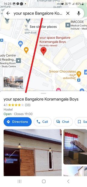
- Search for the location you are interested in on Google Maps.
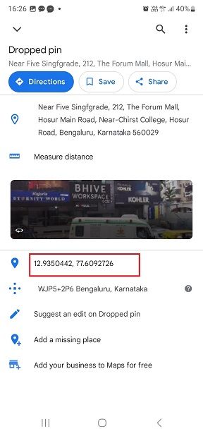
- Touch and hold an area of the map that isn’t labelled to drop a red pin.
- Now copy the coordinates in the search box.
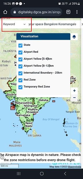
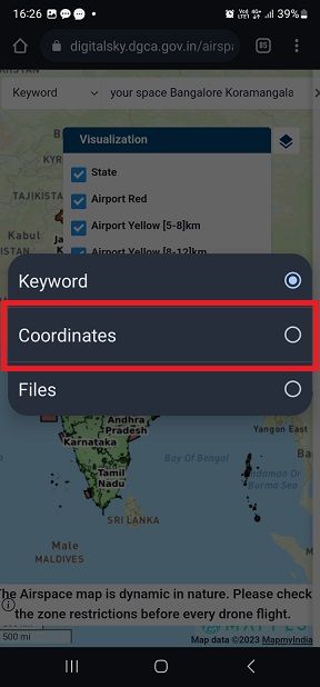
- Visit the Airspace Map app and near the search box, identify the dropdown and select coordinates.
- Enter the coordinates copied from Google Maps onto Airspace Map search.
Example:
Let's check if your space Bangalore Koramangala Boys is a Green Zone or not.
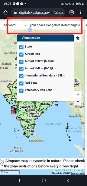

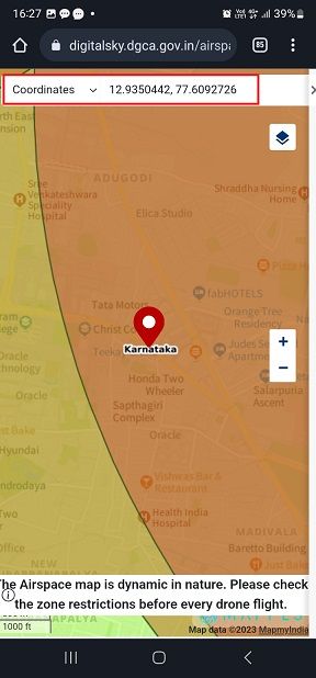
As you can observe, the coordinate fall onto the Red Zone. This is why it is important to do this activity to be sure that you are flying a drone in a safe zone.
Share this article
Copy and share this article: narendravardi.com/gmaps-mapmyindia/
Recommendations
If you liked this article, you might also enjoy reading the following.
- ✍️Why DJI Mini3 Pro is the best beginner drone - Part I
- 📷Minimalist photographs of farm fields
- 🔥 Breath-taking 360° photograph up in the air
- Follow @worthyphotographer on Instagram
❤️ Enjoyed this article?
Forward to a friend and let them know where they can subscribe (hint: it's here).
Anything else? Comment below to say hello, or drop an email!